


FY25 
- Perkins Drive – from Chases Pond Road S to Chases Pond Road N (3,304 feet)
- Mountain Road – from Chases Pond Road to Clay Hill Road (5,844 feet)
- Betty Welch Road – from Beech Ridge Road to Kittery Town Line (2,478 feet)
- Norwood Farms Road – from Tall Oaks Drive to York Street (2,053 feet)
- River Road – from Clark Road to Route One (1,872 feet)
- Harris Island Road – from Route 103 to 1669’ S of Rte 103 (1,657 feet)
- Avon Avenue – from Long Sands Road to dead end (851 feet)
- Ferry Lane N – from Cider Hill Road to Dead End (1,002 feet)
- Darcy Road – from Boban Road (E) to Boban Road (W) (2,332 feet)
- Youngs Lane – from Woodbridge Road to Dead End (374 feet)
- Mountain Road – from Mountain View Lane to 700’ W Mt. A Road (3,687 feet)
- Leavitt Farm Lane – from Brixham Road to Cul-de-Sac (1,800 feet)
- Perkins Court – from Chases Pond Road to Perkins Drive (1,575 feet)
- Nubble Road (Phase 4) – from Third Ave to Shelton Ave (965 feet)
FY24

- Broadway Ext – from Long Beach Ave to dead end (608 feet)
- Orchard Farm Road – from Greenacre Drive to cul-de-sac (430 feet)
- Berwick Road – from S Berwick Line to North Village Road (7,117 feet)
- Old Seabury Road – from Seabury Road to dead end (699 feet)
- Simpson Lane – from York street to dead end (463 feet)
- Pine Hill South Road – from Pine Hill Road to Ogunquit Town Line (2,112 feet)
- Pudding Lane – from Cider Hill Road to dead end (1,747 feet)
- Williams Avenue – from York street to 164’ E York Street (456 feet)
- Sunny Crest Road – from Cornswamp Road to dead end (795 feet)
- Parish Lane – from York street (E) to York street (W) (849 feet)
- Parish Lane – from Parish Lane (E) to Parish Lane (W) (336 feet)
Clay Hill Road - Marietta Avenue – from Broadway Ext to Ocean Avenue (346 feet)
- Raynes Neck Road – from Brave Boat Harbor to Godfrey Cove (1,417 feet)
- Ogunquit Road – from 2224’ E No Village to Ogunquit Town Line (1,724 feet)
- High Pine Road – from Cider Hill Road to cul-de-sac (1,500 feet)
- Greenacre – from Orchard Farm N to Orchard Farm S (1,206 feet)
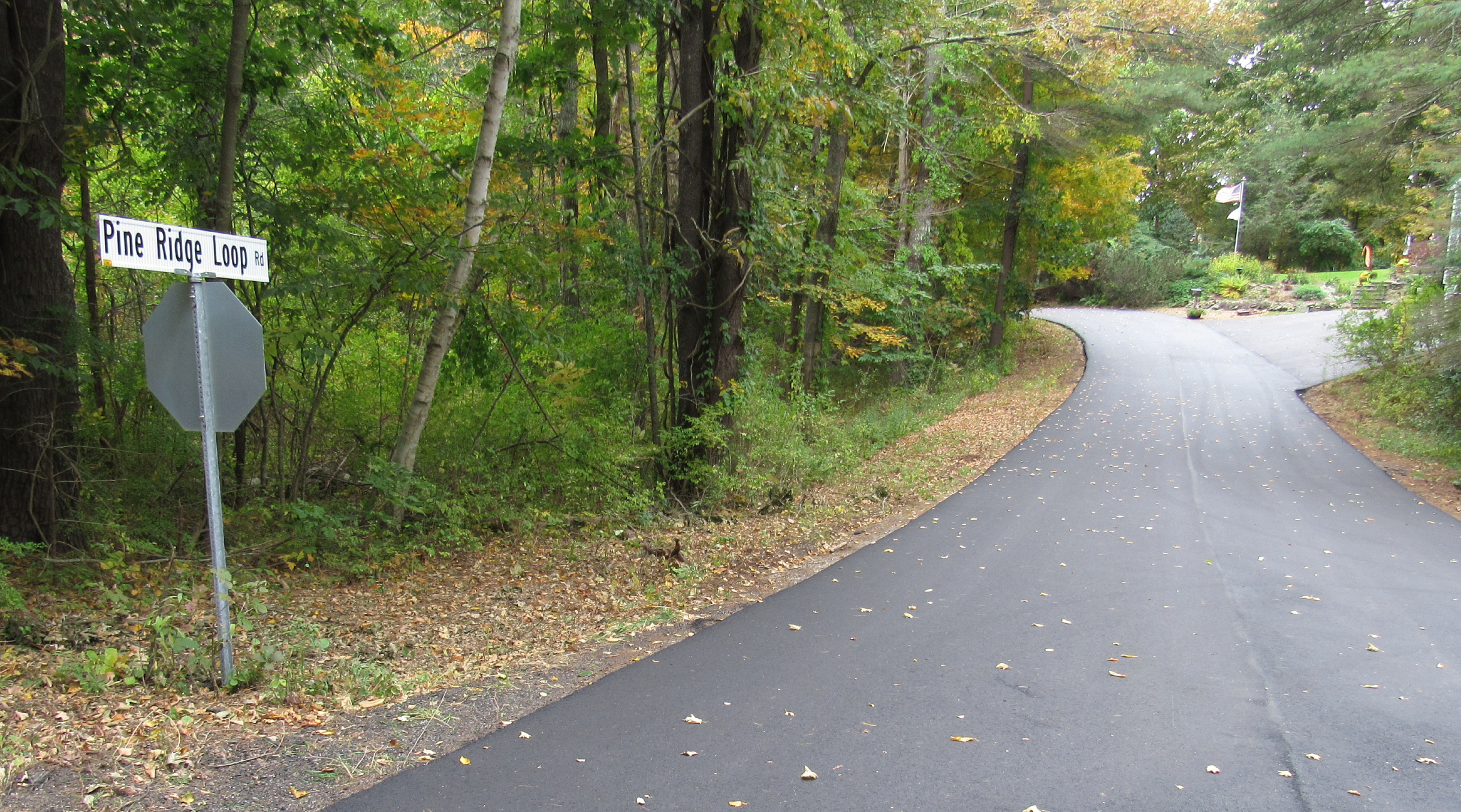
- Woodside Meadow – from Pine Ridge Loop to cul-de-sac (2,671 feet)
- Angel Avenue – from Woodbridge Road to dead end (684 feet)
- Raydon Road Ext – from Raydon Road to Raydon Road ext. (875 feet)
- North Village Road – from 5625’ N Clay Hill to Ogunquit Road (4,922 feet)
- Seaberry Lane – from Beach street to Freeman street (261 feet)
- Seahawk Lane – from Flint Rock Drive to Orchard Farm (429 feet)
- Lindsay Road – from York street to 481’ S of York Street (464 feet)
- Roaring Rock Road – from York Street to Wavecrest Drive (955 feet)
- Colby Turner Lane – from Birch Hill Road to dead end (638 feet)
- Orchard Farm Road – from US 1 to Seahawk Lane (975 feet)
- Raynes Neck Road – from Godfrey Cove to Gardener Cr (2,089 feet)
- Pepperell Way – from Braveboat Harbor to End of Paved Road (2,111 feet)
- River Road – from Old County Road to Clark Road (1,205 feet)
FY23
- Fernald Avenue – from Camden Avenue to Avon Avenue (491 feet)
- Little River Drive – from Fieldstone Est. Road to cul-de-sac (566 feet)
- Fernald Avenue – from Long Sands Road to Camden Avenue (1,401 feet)
- Chickadee Drive – from Meadowlark Drive So. To Meadowlark Drive North (1,310 feet)
- Stoney Brook – from Logging Road to cul-de-sac (1,330 feet)
- Pine Ridge Loop – from Woodside Meadow to cul-de-sac (706 feet)
- Winterbrook Drive WB – from Organug Road to Mallard Drive (803 feet)
- Egret Circle – from Chickadee Drive to cul-de-sac (559 feet)
- Storage Drive – from Goundnut Hill Road to dead end (299 feet)

Pine Ridge Loop - Candlewood Lane – from Fieldstone Est. Road to cul-de-sac (1,182 feet)
- Osprey Lane – Meadowlark Drive to Osprey Lane (2,205 feet)
- High Street – from Main street to Freeman Street (533 feet)
- Frost Hill Road – from Birch Hill Road to Eliot town line (2,043 feet)
- Clay Hill Road – from .9 Mi East of Logging to town line (3,232 feet)
- Earline Circle – from Graystone Lane to cul-de-sac (614 feet)
- Algonquin Drive – from Groundnut Hill Road to dead end (1,852 feet)
- Heather Road – from Scotland Bridge Road to Tarton Road (579 feet)
- Pinecrest Drive – from Scotland Bridge Road to dead end (1,239 feet)
- Malcolm Road – from Scotland Bridge Road to dead end (706 feet)
- Kimball Farm Lane – from Beech Ridge Road to cul-de-sac (1,295 feet)
- New Town Road – from Route 1 to dead end (2,973 feet)
Keith Road - Camden Avenue – from Fernald Avenue to Field Avenue (450 feet)
- Norwood Avenue – from Freeman Street to dead end (240 feet)
- Newport Avenue – from Freeman Street to dead end (405 feet)
- Reserve Street – from Beacon Street to Oceanside Avenue (788 feet)
- Milbury Lane – from Norwood Farms Road to dead end (724 feet)
- Bluestone Lane – from Old Post Road to Bluestone Lane (638 feet)
- Keith Road – from Tarton Road to dead end (388 feet)
- Graystone Lane – from Bluestone Lane to Hemlock Avenue (1,614 feet)
- Moulton Farm Lane – from Clay Hill Road to private property (1,015 feet)
- Ramsdell Lane – from Clay Hill Road to dead end (281 feet)
- Belmont Avenue – from Freeman street to dead end (306 feet)
- Tarton Road – from Malcolm Road to Clyde Road (1,047 feet)
- Clay Hill Road – from Greenleaf Parsons to Josiah Norton Road (1,311 feet)
FY22

- Beach Ball Field Road – from Church Street to Bay Street (618 feet)
- Deer Run – from Saltwater Drive to cul-de-sac (1,280 feet)
- Whip Poor Will – from Shore Road to cul-de-sac (833 feet)
- Sunrise Terrace – from Scituate Road to dead end (3,453 feet)
- Chases Pond Road – from Gertrude Lane to Mountain Road (5,150 feet)
- Old McIntire Road – from Cider Hill Road to dead end (774 feet)
- Saltwater Drive – from Deer Run to Riverwood Drive (1,653 feet)
- Rivermeadow Lane – from Southside Road to Rivermeadow Lane (564 feet)
- Barrell Lane Ext – from Barrell Lane to cul-de-sac (909 feet)
- Georgia Street – from York Street to dead end (806 feet)
Lobster Cove Road - Hannaford Drive – from Cider Hill Road to US 1 (1,867 feet)
- Southside Road – from Route 1 to Snap Hook Drive (1,872 feet)
- Hemlock Ridge – from Brixham Road to cul-de-sac (1,318 feet)
- Seawalls Pasture – from Mountain Road to Gravel Road (2,094 feet)
- Logging Road – from Route 1 to Clay Hill Road (9,332 feet)
- Lobster Cove Road – from Longs Sands Road to dead end (1,043 feet)
- Bay Street – from Beach Ball Field Road to Railroad Avenue (173 feet)
- Rivermeadow Lane Ext – from Rivermeadow Land to dead end (716 feet)
- Netherby Lane – from Sunrise Terrace to Sunrise Terrace (573 feet)
- Dover Bluff – from Nubble Road to Fourth Ave (462 feet)
FY21
- Jeffrey Lane – from Southside Road to cul-de-sac (2,466 feet)
- Hickory Lane – from Old Mast Road to cul-de-sac (946 feet)
- Deacon Drive – from Payne Road to cul-de-sac (925 feet)
- Braveboat Harbor Road – from Raynes Neck road to High Rock Road (1,907 feet)
- Sea Trumpet – from York Street to cul-de-sac (571 feet)
- Payne Road – from route 103 to Kittery line (331 feet)
- Pine Hill Road – from Ledge View Lane to Route 1 (5,082 feet)
- Braveboat Harbor Road – from High Rock Road to Route 103 S (1,819 feet)
- Broadway Ave – from 182’ E Airport Drive to Willow Avenue (235 feet)
- Ferry Lane S – from Route 1 to dead end (1,787 feet)
- Scituate Road – from Chases Pond Road S to Bog Road (2,642 feet)
- Braveboat Harbor Road – from West Point Road to Raynes Neck Road (746 feet)

Southside Road - Snowden Ridge Road – from Chases Pond Road to cul-de-sac (1,434 feet)
- Prebble Lane – from Old East Scituate to dead end (1,200 feet)
- Elm Drive – from Long Sands Road to dead end (476 feet)
- Pine Hill North Road – from Pine Hill South Road to Ogunquit Town Line (2,058 feet)
- Axholme Road – from Woodbridge Road to York Street (1,132 feet)
- Long Beach Avenue – from Juniper Road to Oceanside Avenue (1,529 feet)
- Braveboat Harbor Road – from Route 103 N to West Point Road (481 feet)
- Willow Avenue – from Ocean Avenue ext to Broadway Avenue (354 feet)
- Pine Hill Road – from 308’ N Pine Hill S to Ledge View Lane (6,166 feet)
